| Today is: | September 22 | ||
| We woke up in: | Moab UT | We're going to sleep in: | Moab, UT |
|
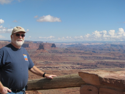
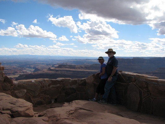
Shel: We started out by scheduling an ATV adventure for tomorrow morning! We left the campground to go to Canyonlands and only made one wrong turn, the one out of the campground. Realized our mistake about 20 miles later :) At viewpoints we met a couple from New Hampshire! We also met a couple noe in their 80's, but used to bike all over the place including Europe - as little as 4 years ago! Great scenery! 
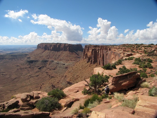
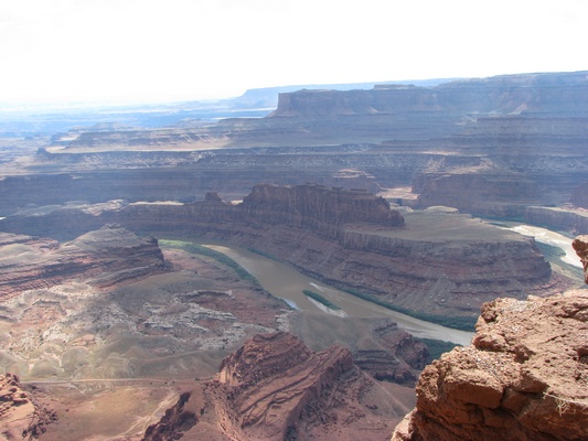
Geni: As much as I loved seeing the mountains and trees, I really do love the warmth and this part of the country the best. Cliffs and canyons as far as the eye can see -- panoramic views of all natural rock formations and such pretty colors. We drove through the Island in the Sky section of Canyonland which is one of three areas of the park. There were so many foreigners today. At one point, we seemed to be the only people speaking english. We also went on a search for Indian pictographs. It was a great road with high cliffs on both sides, however, we only found one spot that we really could see some pictographs. Pano: |
|||
This is called Wilson Arch, which we found as we were going the wrong way out of the campground |
These formations were named for the Monitor and Merrimack ships. It said they look like the ships from the Civil War (both sank) |
That's me!! People were standing on this Mesa Arch and Shel told me to try it. |
This is the view looking down from the left, so I just kept looking straight ahead. It was a wide enough arch, but still pretty scary. |
Grand View Point overlook along canyon edge |
Grand View Point |
This was part of steep walk up to Upheaval Dome |
|
The scientists don't understand why the top split open leaving this brown dome |
So many different rock colors |
Green River Outlook was another site that had great canyons and cliffs |
The Colorado River runs through this area called Dead Horses Point |
Pictographs are from thousands of years BC - We drove on this beautiful road Rt. 279 south with high cliffs on both sides |
Jug Handle Arch - found this also on that road, on our search for more pictorgraphs |